Hyperlocal Air Quality Prediction using Machine Learning in East Bay Area, CA
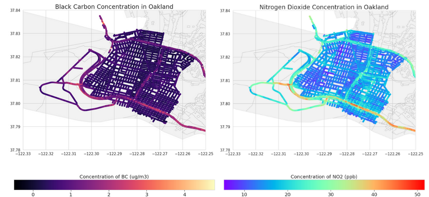
Open source web-application to predict air quality on a city-block basis in Oakland and San Leandro, CA using machine learning models, trained on publicly available datasets on local pollutant concentrations, local meteorological data, emissions from local industrial sources, and traffic emissions.
* Web-application
* Source code
* Blog post